
Cat Winterfox [best name ever?] from Spooky Moon Books graciously sent me a couple of Portland-related books a couple months ago. I’d like to publicly thank her. Thanks Cat!
One of the books really caught my eye: a bound copy of the Albina Neighborhood Improvement Committee newsletter called Aniic Dope. The book is a compilation of the monthly bulletins published by the committee “illustrating the activities of the Portland Development Commission and the Alberta Neighborhood Improvement Committee.”
According to the committee, the project is “a prime example of how citizens of a neighborhood united in response to the challenge of physical and social decay.”
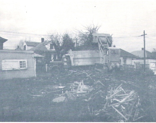
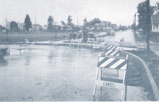
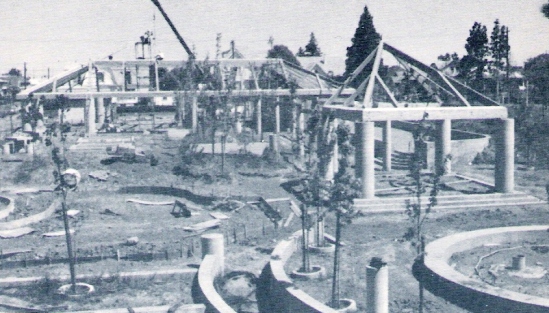
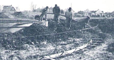
Of course it’s chock full of photos, some of which I scanned.
The book is a real time-machine of a neighborhood struggling to renew itself, stories about the people who lived in the neighborhood and a definite late 60s vibe.
Much of the book focuses on the new jewel of the hood: Unthank Park. Following are photos of the park being built.

A quick news search reveals there’s been lots of crime in the park since its inception. One of the most recent articles was from 2001 – then again, that’s a lifetime ago for that neighborhood.
Part two of the post will look at some of the folks that lived in the neighborhood and some more rebuilding photos.
If you live in the Alberta neighborhood [defined in the book as North Vancouver on the East; North Fremont on the south and North Albina on the west] shoot me your address and I’ll see if your home is included – there are tons of shots of homes being remodeled.
Discover more from Lost Oregon
Subscribe to get the latest posts sent to your email.

[…] some Portland gems in a lot of books I’d purchased, I sent them to John at Lost Oregon. Here is the first post using that material. As expected, he’s pulling out great […]
Wow. This is why I love your site. Lots of old photos and info that is unavailable elsewhere. Can’t wait for the other photos.
I used to live own the house on the Northeast Corner of Unthank Park, 2000-2004. Lots of shooting around there during those years. The address was 339 N Shaver. I would love to see any pictures from back then. Thanks.
The park used to be very unsafe, but it is much better now. A school/community center (SEI) was built there in about 2000 or so…
Hey There,
Love the site…
I too love the city’s history, and catch myself perusing old images located all over the portland building and other various locations around town. I run into all sorts of old photos doing my job with the city, and I wanted to mention the city’s archive website.
It’s called efiles:
http://efiles.ci.portland.or.us/
Another thing that has reshaped the city’s geography was the construction of freeways. When the built I-84, I-5, I-405, etc…they had to move and destroy whole city blocks to create the freeways. Check it out:
http://efiles.ci.portland.or.us/webdrawer/search/rec?sm_anyword=freeway%20construction&count&from=2622495&page=4
Send me an email!
How can anything called Unthank Park ever be successful? The name alone makes a trigger finger itchy.
Laurie – Unthank Park was named after Norval Unthank, one of the first African-American physicians in Portland. Maybe an odd name, but no odder than Josiah Failing, who (I think?) was the founder of PPS